Technical Information
The images on this website are calculated synthetically with a computer. Using data of the earth surface form and its coloring a rendering software calculates images from a choosen perspective with a selectable lighting. Here you can find some more information on how this works.
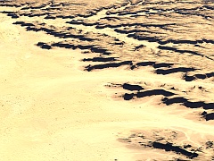
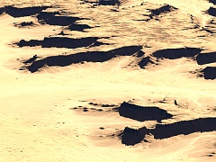
In general creating realistic images of the earth surface based on recorded data is quite difficult due to the large amounts of data involved. Rendering on of the images here for a large size print easily requires 100 million or more data points (elevation and color) to be processed for an accurate representation of the surface up to the foreground. A lot of commonly used rendering systems are not capable of handling this efficiently.
The Raytracer POV-Ray offers the unique feature of rendering such geometries without generating polygon meshes to represent the geometry first. This is immensely useful because it reduces the necessary pre-processing of the data and the memory requirements for rendering. It also avoids meshing artefacts but guarantees a completely smooth surface instead.
 |
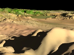 |
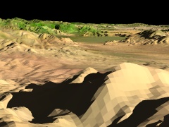
 |
| flat polygon mesh | smoothed polygon mesh | POV-Ray isosurface |
At the same time POV-Ray offers all functionality required for generating realistic images with accurate reflections, shadows and atmospheric scattering. But since the images are synthetically generated we of course do not have to cope with all the things that limit the clear view on the earth surface in reality like clouds and dust.
 |
 |
 |
| self-shadowing of the relief | reflections | atmospheric scattering |
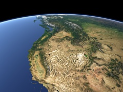
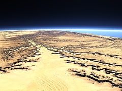
To accurately render the earth surface from higher altitudes it is also necessary to model the earth surface curvature. This is correctly done in the images here as well so all views have an accurately curved horizon.
Due to the efficient handling of geometry data in POV-Ray views can be rendered in very high resolution. Size of the pictures is mostly limited by the available data sources.
 |
 |
 |
 |
 |
 |
| image resolution examples | ||
Some more detailed information about the technical aspects of rendering the earth surface can be found on my website.
imagico.de • blog.imagico.de • services.imagico.de • maps.imagico.de • earth.imagico.de • photolog.imagico.de