Related Views:
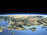
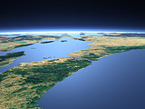

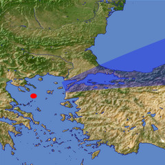
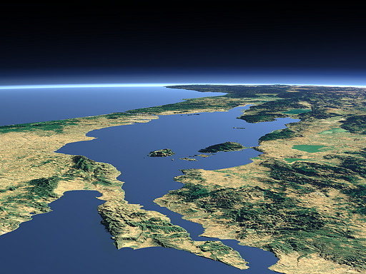
Between the Bosporus (background) and the Dardanelles (foreground) lies the Sea of Marmara connecting the Black sea to the Mediterranean Sea and marking the border between Asia and Europe. South of the Sea of Marmara the lakes Kuş Gölü Ulubat Gölü İznik Gölü and Sapanca Gölü can be seen.
| View: | The Sea of Marmara |
| Location: | Lon 24.259° Lat 39.631° |
| Altitude: | 59 km |
| Direction: | 72° |
| Camera Angle: | 24° |
| User Rating: | 2.6 |
Visitor comments:
Do you also believe that for this canal British, French, Avustralian, New Zelland fight with Turks and Curchill was resigned for their loose from the Ministry of Defence. And 200.000 soilders were lost their lifes.
Australia and Newzelland still memoraties this day on 25th of April every year as the ANZAC day.
By submitting your comment you agree to the privacy policy and agree to the information you provide (except for the email address) to be published on this website.