Canary Islands 1
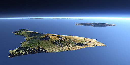
The Canary Islands are a group of islands of volcanic origin near the north African coast. In the foreground there is Tenerife with the highest peak, the Pico de Teide (3718 m), behind Gran Canaria and in the background Fuerteventura and Lanzarote.
| View: | Canary Islands 1 |
| Location: | Lon -17.479° Lat 28.113° |
| Altitude: | 19 km |
| Direction: | 85° |
| Camera Angle: | 45° |
| User Rating: | 2.4 |
Location Map: Visible Topography

Home •
Impressum •
Terms •
Sitemap •
Browse:
list
/
map /
gallery •

imagico.de • blog.imagico.de • services.imagico.de • maps.imagico.de • earth.imagico.de • photolog.imagico.de
imagico.de • blog.imagico.de • services.imagico.de • maps.imagico.de • earth.imagico.de • photolog.imagico.de


Visitor comments:
Schoenen Sonntag und beste Gruesse von Tenerife.
Deine Bilder sind absolute Klasse!
Alles Beste max
By submitting your comment you agree to the privacy policy and agree to the information you provide (except for the email address) to be published on this website.