Related Views:


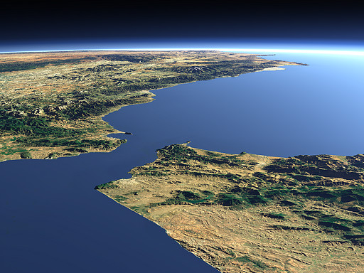
The Strait of Gibraltar connects the Mediterranean Sea (right) to the Atlantic Ocean (left) separating Morocco (foreground right) from Spain (background left). On the mediterranean side the Rock of Gibraltar and the mountains near the Spanish exclave Ceuta form the Pillars of Hercules known from ancient mythology. In the background the Sierra Nevada mountains in southern Spain (3482m).
| View: | The Strait of Gibraltar |
| Location: | Lon -7.095° Lat 34.698° |
| Altitude: | 59 km |
| Direction: | 50.6° |
| Camera Angle: | 34° |
| User Rating: | 2.4 |

Visitor comments:
nice view thanks.
but where is buildings :D
By submitting your comment you agree to the privacy policy and agree to the information you provide (except for the email address) to be published on this website.