Related Views:
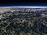

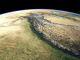
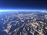

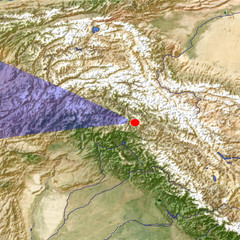
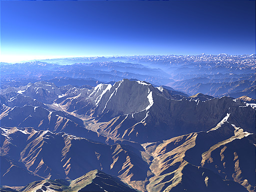
The Nanga Parbat (8125m) marks the western end of the main Himalaya Mountain ridge. Behind the mountain the Indus River has carved a valley through the mountains forming a height difference of about 7000m towards it.
| View: | The Nanga Parbat |
| Location: | Lon 75.08° Lat 35.156° |
| Altitude: | 13 km |
| Direction: | 282° |
| Camera Angle: | 38° |
| User Rating: | 2.6 |
Visitor comments:
Peace.
Aabi
By submitting your comment you agree to the privacy policy and agree to the information you provide (except for the email address) to be published on this website.