Related Views:
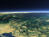

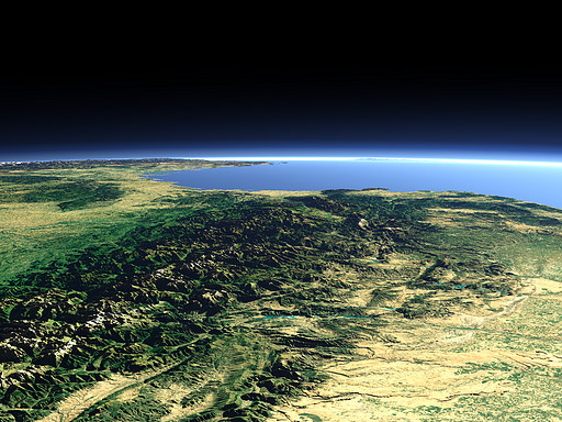
The mountain range of the Pyrenees separates the Iberian Peninsula from France. The highest Peak - the Aneto (3404m) can be seen in the center left. In the background the coast of southern France, the southwestern end of the Alps and in the far background the island of Corsica can be seen.
| View: | Pyrenees 1 |
| Location: | Lon -2.04° Lat 42.014° |
| Altitude: | 59 km |
| Direction: | 80° |
| Camera Angle: | 36° |
| User Rating: | 2.6 |
Visitor comments:
I wish you to develop your images every country aside especially Spain at least to distinguish between the green areas and deserted areas
and I will by thankful for you if you take an image for Syria
Keep it up!
By submitting your comment you agree to the privacy policy and agree to the information you provide (except for the email address) to be published on this website.