Views of the Earth

artificial images of our real planet
The Scandinavian Peninsula location map

The Scandinavian Peninsula

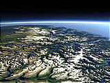
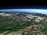
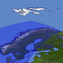
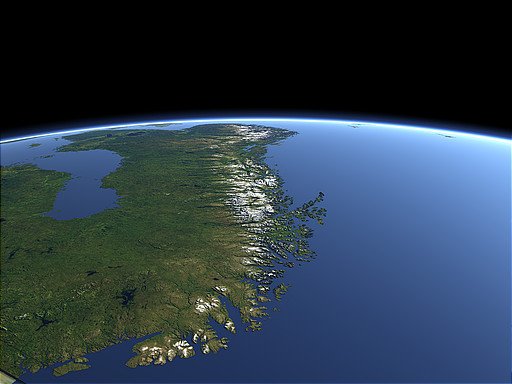
The Scandinavian Peninsula in northern europe has been covered by a thick ice sheet during the last Ice Age and its surface is primarily formed by the glaciers. The western coast is structured by many fjords.and islands while the eastern coast slowly inclines towards the Baltic Sea. In the close foreground the North Cape and the northmost point of the European mainland can be seen.

View: The Scandinavian Peninsula
Location: Lon 47.818°
Lat 75.342°
Altitude: 729 km
Direction: 215°
Camera Angle: 40°
User Rating: 2.5
Location Map:    Visible Topography
The Scandinavian Peninsula location map
The Scandinavian Peninsula

Related Views:

The Sognefjord and Jotunheimen
The Mountains and Fjords of southern Norway
Western Europe

Visitor comments:

no comments yet.

Leave a comment
You have to enable Javascript to be able to write comments.
human verification Please enter the code you can see in the image on the left to verify you are a human and not a spamming script.
* * Required field
Information about you
*
will not be made public
will be displayed with your posting
Your comment (no HTML)

*

If you want to send a private message to the author of this website you can do so via Email.

The comments will be reviewed before they are added to the site. So you might need to wait some time until your entry turns up.

Please note this comment function is intended for commenting on the text and images, not for discussing political or religious views. Comments with no relation to the content of this site will not be approved.

By submitting your comment you agree to the privacy policy and agree to the information you provide (except for the email address) to be published on this website.

  
Design and Content Copyright 2023 by Christoph Hormann
last updated Sun, 16 Jul 2023 20:38