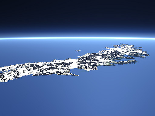
South Georgia
The island of South Georgia lies in the southern Atlantic Ocean. More than half of it is covered by glaciers. The highest peak, Mount Paget (2935m) in the Allardyce Range in the center of the island can be seen in the middle of this view.
| View: | South Georgia |
| Location: | Lon -34.734° Lat -54.594° |
| Altitude: | 19 km |
| Direction: | 275° |
| Camera Angle: | 40° |
| User Rating: | 2.8 |
Location Map: Visible Topography

Home •
Impressum •
Terms •
Sitemap •
Browse:
list
/
map /
gallery •

imagico.de • blog.imagico.de • services.imagico.de • maps.imagico.de • earth.imagico.de • photolog.imagico.de
imagico.de • blog.imagico.de • services.imagico.de • maps.imagico.de • earth.imagico.de • photolog.imagico.de


Visitor comments:
Peter Hanson
By submitting your comment you agree to the privacy policy and agree to the information you provide (except for the email address) to be published on this website.