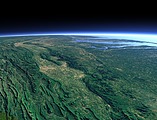
The Chesapeake Bay
The Chesapeake Bay is a large bay at the east coast of north America formed by a large number of rivers draining into the Atlantic Ocean, the largest being the Susquehanna River (right side), the Potomac River (center) and the James River (left). On the right side at the northern end of the bay you can see the US capital Washington D.C. and Baltimore and in the background the Appalachian Mountains.
| View: | The Chesapeake Bay |
| Location: | Lon -75.115° Lat 36.435° |
| Altitude: | 39 km |
| Direction: | 318° |
| Camera Angle: | 48° |
| User Rating: | - |
Location Map: Visible Topography

Home •
Impressum •
Terms •
Sitemap •
Browse:
list
/
map /
gallery •

imagico.de • blog.imagico.de • services.imagico.de • maps.imagico.de • earth.imagico.de • photolog.imagico.de
imagico.de • blog.imagico.de • services.imagico.de • maps.imagico.de • earth.imagico.de • photolog.imagico.de


Visitor comments:
no comments yet.
By submitting your comment you agree to the privacy policy and agree to the information you provide (except for the email address) to be published on this website.