Mont Blanc
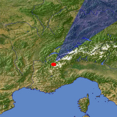
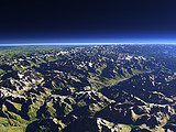
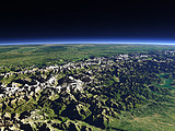
The Mont Blanc (4808m) is the highest peak in the Alps and lies at the border between France and Italy. This view from the south shows the fairly steep and rugged south side of the massif facing the Aosta Valley on the right. On the left the Haute-Savoie in France and in the background the Rhône valley.
| Ansicht: | Mont Blanc |
| Position: | Lon 6.564° Lat 45.452° |
| Höhe: | 13 km |
| Richtung: | 30° |
| Kamerawinkel: | 26° |
| Bewertung: | 2.5 |
Umgebungskarte: Optisch Topographie
Start •
Impressum •
Nutzungsbedingungen •
Sitemap •
Bilder:
Liste
/
Karte /
Galerie •

imagico.de • blog.imagico.de • services.imagico.de • maps.imagico.de • earth.imagico.de • photolog.imagico.de
imagico.de • blog.imagico.de • services.imagico.de • maps.imagico.de • earth.imagico.de • photolog.imagico.de


Kommentare:
Durch das Abschicken Ihres Kommentars stimmen Sie der Datenschutzrichtlinie zu und erlauben, dass die eingegebenen Informationen (mit Ausnahme der eMail-Adresse) in diesem Blog veröffentlicht werden.