Views of the Earth

artificial images of our real planet
The Maritime Alps location map

The Maritime Alps

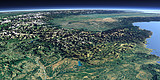
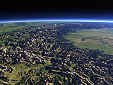
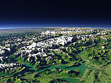
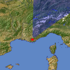
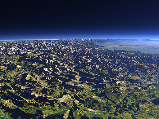
The Maritime Alps mark the eastern end of the Provence and the border between France (foreground) and Italy (background). In the near foreground the Verdon river and the upper part of the Verdon Gorge can be seen. In the background the higher parts of the western Alps and the Po Basin in northern Italy.

View: The Maritime Alps
Location: Lon 6.214°
Lat 43.42°
Altitude: 19 km
Direction: 23°
Camera Angle: 42°
User Rating: 2.7
Location Map:    Visible Topography
The Maritime Alps location map
The Maritime Alps

Related Views:

The Alps from the west
The southwestern Alps
The upper Rhône River
The Bernese Alps from north

Visitor comments:

no comments yet.

Leave a comment
You have to enable Javascript to be able to write comments.
human verification Please enter the code you can see in the image on the left to verify you are a human and not a spamming script.
* * Required field
Information about you
*
will not be made public
will be displayed with your posting
Your comment (no HTML)

*

If you want to send a private message to the author of this website you can do so via Email.

The comments will be reviewed before they are added to the site. So you might need to wait some time until your entry turns up.

Please note this comment function is intended for commenting on the text and images, not for discussing political or religious views. Comments with no relation to the content of this site will not be approved.

By submitting your comment you agree to the privacy policy and agree to the information you provide (except for the email address) to be published on this website.

  
Design and Content Copyright 2023 by Christoph Hormann
last updated Sun, 16 Jul 2023 20:38