Related Views:
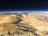
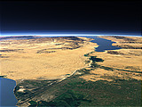
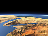
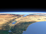

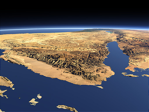
The Sinai Peninsula can be found at the northern end of the red sea between the Gulf of Suez (left) and the Gulf of Aqaba (right) - the latter pointing towards the Dead Sea depression further north. The Sinai is of major importance in Jewish and Christian mythology.
| View: | The Sinai Peninsula |
| Location: | Lon 33.938° Lat 26.619° |
| Altitude: | 51.863 km |
| Direction: | 5° |
| Camera Angle: | 43° |
| User Rating: | 2.4 |

Visitor comments:
3D renderings like this one are an incredible asset as true aerial or satellite photography would simply not allow such a long clear view of the Earth. The topography of the area can be viewed as in no other way.
My lighting things a bit harshly the true 3-dimensional perspective is gained. Softer lighting would make features more difficult to analyze.
Great job, an a nice clean website. A real asset on the Internet.
:::tipping hat:::
Thanks . . . Dorian
By submitting your comment you agree to the privacy policy and agree to the information you provide (except for the email address) to be published on this website.